Comprehensive Safety Action Plan
The FHWA Safe Streets for All (SS4A) program, part of the Bipartisan Infrastructure Law, provides $5 billion between 2022 and 2026 primarily to local governments for roadway safety improvements. Before local jurisdictions can apply for SS4A grants, a roadway safety plan must be in place. To fulfill this requirement and to set a cohesive regional safety vision, WFRC completed a Comprehensive Safety Action Plan (CSAP) for its council area, including Davis, Salt Lake, Morgan, Tooele, Weber, and southern Box Elder counties, in April 2024. Development of the plan began in July 2023 and involved extensive stakeholder engagement and in-depth roadway safety analysis spanning several months.
WFRC’s Transportation Coordinating Committee (Trans Com) voted to adopt the CSAP on April 25, 2024. The CSAP, which can be accessed below, fulfills the plan requirement for SS4A implementation grant applications and also serves as a resource for local jurisdictions in the WFRC area working to improve roadway safety.
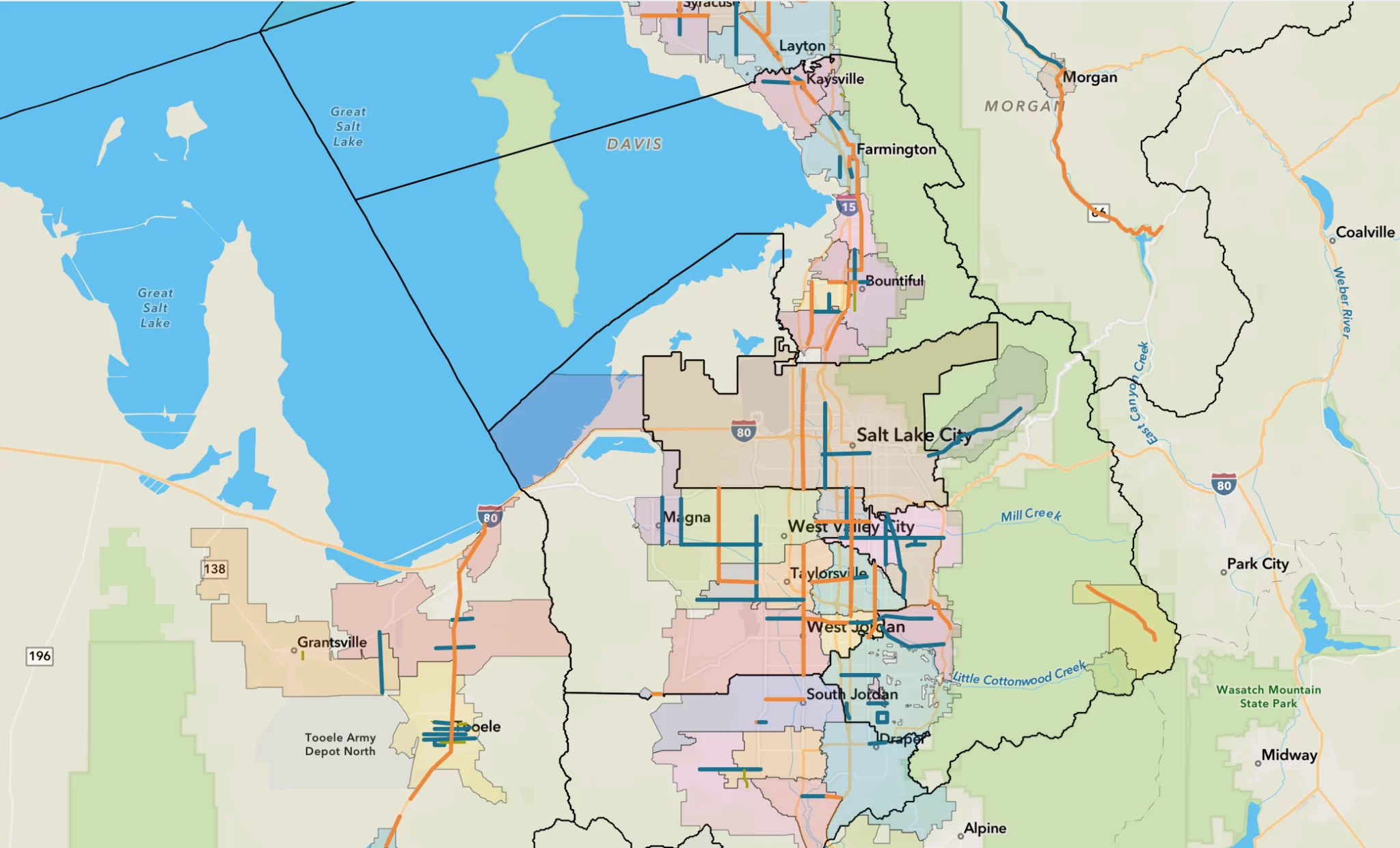
Local jurisdictions can access additional information about safety needs on specific roadway segments via this GIS Story Map.
Comprehensive Safety Action Plan
The FHWA Safe Streets for All (SS4A) program, part of the Bipartisan Infrastructure Law, provides $5 billion between 2022 and 2026 primarily to local governments for roadway safety improvements. Before local jurisdictions can apply for SS4A grants, a roadway safety plan must be in place. To fulfill this requirement and to set a cohesive regional safety vision, WFRC completed a Comprehensive Safety Action Plan (CSAP) for its council area, including Davis, Salt Lake, Morgan, Tooele, Weber, and southern Box Elder counties, in April 2024. Development of the plan began in July 2023 and involved extensive stakeholder engagement and in-depth roadway safety analysis spanning several months.
WFRC’s Transportation Coordinating Committee (Trans Com) voted to adopt the CSAP on April 25, 2024. The CSAP, which can be accessed below, fulfills the plan requirement for SS4A implementation grant applications and also serves as a resource for local jurisdictions in the WFRC area working to improve roadway safety.
Local jurisdictions can access additional information about safety needs on specific roadway segments via this GIS Story Map.
Executive Summary
Final Plan
GIS Story Map - Supplemental Safety Information
Related Resources
To download specific sections of the CSAP appendices, click below. Appendix D is downloadable by Geographic Focus Area (GFA).
Appendices
Geographic Focus Area (GFA) Safety and Analysis and Case Study Projects
- Appendix D: Technical Memo #1 – Safety Analysis
- Appendix D1: South Box Elder & North Weber County
- Appendix D2: Western Weber County
- Appendix D3: Eastern Weber County & Morgan County
- Appendix D4: Central Weber County
- Appendix D5: Salt Lake City
- Appendix D6: North Davis County
- Appendix D7: South Davis County
- Appendix D8: East Salt Lake Valley
- Appendix D9: West Salt Lake Valley
- Appendix D10: South Salt Lake Valley
- Appendix D11: Tooele County
Contact
For additional information, please contact:

Fariba Soltani
Transportation Analyst